
There’s a quiet assumption behind many organizational decisions today: if the data looks complete, the decision must be informed.
Dashboards are filled with metrics. Reports are carefully prepared. Leadership teams review performance trends, growth projections, and operational targets with confidence. On paper, everything appears accounted for, yet projects still underperform, expansions miss expectations, and operational challenges emerge that no one anticipated.
When leaders ask, “Why didn’t this work the way we expected?” the answer is rarely about effort or intent. More often, something fundamental was missing from the decision itself.
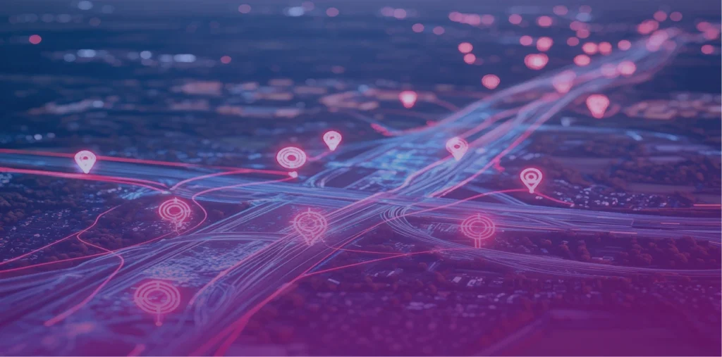
The missing piece is Geography.
The Missing Dimension in Decision-Making
Organizations have become exceptionally good at understanding what is happening and how much is happening. Revenue is tracked, service usage is measured, and performance indicators are monitored in real time. But many decisions are still made without fully understanding where outcomes are actually taking place.
Location is often treated as background context rather than a driving factor. Yet every customer interaction, operational process, and service outcome exists within a physical environment shaped by access, infrastructure, demographics, and distance.
When location isn’t considered, decisions become detached from the environments they are meant to serve. Strategies that look logical in aggregate data begin to struggle once they encounter real-world complexity.
When Decisions Become Location-Blind
Location-blind decision-making rarely happens intentionally. It emerges through routine processes that prioritize averages over patterns.
A leadership team reviews regional performance summaries and sees stable numbers. A new initiative is rolled out evenly across service areas because demand appears consistent. Resources are distributed based on population totals rather than accessibility or local conditions.
Each step feels reasonable in isolation. The problem is that aggregated data smooths over the very differences that matter most.
Two communities may share identical population sizes while facing entirely different realities, transit availability, economic conditions, infrastructure capacity, or service accessibility. Treating them as interchangeable creates inefficiencies that only become visible after implementation, when teams are forced to react instead of plan.
The Real Cost of Ignoring Geography
Location-blind decisions don’t just create minor inefficiencies. They quietly compound into measurable losses.
1. Money Gets Spent in the Wrong Places
Investments often chase overall demand instead of spatial demand. Facilities open where growth looks strong overall, not where accessibility actually supports usage. Marketing budgets target broad regions instead of high-potential pockets.
The result? Underperforming investments that looked perfectly justified in planning meetings.
2. Operations Become Harder Than They Should Be
Routing inefficiencies. Service overlaps. Coverage gaps. Delays that seem operational but are actually geographic. Teams try to solve these problems with process improvements when the real issue is spatial design.
You can’t optimize operations if you don’t understand the terrain they operate within.
3. Leaders Lose Visibility Into Reality
When geography is missing, leadership sees trends without understanding drivers.
Performance looks inconsistent. Outcomes feel unpredictable. Teams struggle to explain variance. But often, performance isn’t random, it’s spatial.
Geography Is Not a Map. It’s Intelligence.
One of the biggest misconceptions about GIS is that it’s a visualization tool, something used to make maps at the end of a project……..that thinking is outdated.
Modern geographic intelligence answers leadership questions like:
- Where should we expand next, and where should we not?
- Which communities are underserved despite high investment?
- Why do similar locations produce different outcomes?
- Where are operational costs being created unintentionally?
These are leadership questions, not technical ones. Organizations that treat geography as strategic intelligence, rather than a reporting tool, gain a clearer understanding of cause and effect within their operations.
The Shift Smart Organizations Are Making
Forward-looking organizations are changing how geography fits into decision-making. Instead of using spatial analysis as a retrospective explanation, they are embedding it early in planning and strategy.
Before launching programs, they analyze spatial demand patterns. Before allocating resources, they examine geographic equity and accessibility. Before expanding operations, they evaluate how location influences outcomes, costs, and long-term sustainability.
The shift is subtle but transformative. Location moves from visualization to validation. Decisions are no longer based solely on historical averages; they are tested against the environments where they will actually operate. As a result, fewer surprises emerge after implementation because assumptions have already been grounded in reality.
Why Leadership Should Care Now
Today’s operating environment leaves little room for inefficiency. Budgets face greater scrutiny, expectations continue to rise, and organizations are asked to do more with fewer resources. Decisions that work only in theory quickly become expensive lessons.
The advantage no longer comes from having more data. Most organizations already possess vast amounts of information. The real advantage lies in understanding context and the conditions that shape how data translates into outcomes. Geography provides that context by connecting strategy to the physical world. It links numbers to communities, plans to infrastructure, and decisions to lived experience.
A Better Question to Ask
Instead of asking, “Do we have enough data to make this decision?” leaders should begin asking a different question:
“Do we understand where this decision will live?”
If your organization is starting to rethink how location fits into planning, operations, or long-term strategy, the conversation doesn’t need to begin with technology, it starts with understanding your challenges.
Contact ThoughtStorm to explore how geographic intelligence can support smarter, more grounded decision-making across your organization.
